This post has been divided into two parts:
-Part I describes some of the major terrain features
in brief along with relevant pictures from my treks in the Sahyadri
range. Their cartographic representations have been added, wherever
possible.
-Part II describes Forts and their parts. Link to the second part can be found at the bottom of this page.
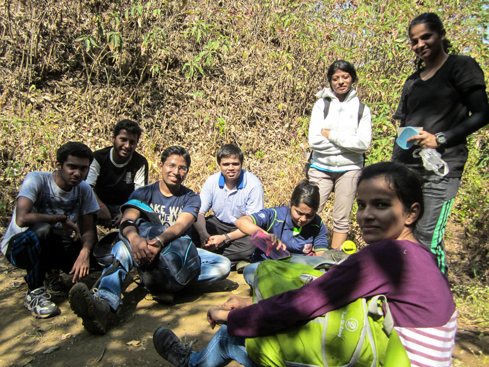
You might have seen this picture before. It’s from the very first trek of ‘A Season Of Mountains’- Vikatgad in Jan ’15.
It’s a pretty routine picture- tired but happy faces taking a break during the climb. Except, it isn’t.
About half an hour before this picture was clicked at the Col, we were bang in the middle of a forest with no visible path. It was a weekday, so we were pretty much the only trekkers on the hill and moreover, hours behind the schedule we had drawn up. Despite spending a week going through blogs and creating a map of the trail, we ended up overshooting our turn to the naal by 3 hills. Yep, three freaking hills. And by the time we realised we had embarked on a rarely used, longer trail to Vikatgad, we were at the point of no return.

The lowest point of the range, Col, was the only landmark we knew on the longer trail. So we walked, stumbled and crawled our way through the forest to somehow reach that Col and that might just be the reason we ended up in our beds that night instead of the newspaper headlines the next morning.
That day, I realised the importance of identifying various terrain features but it still took me a good dozen-odd treks to learn how to navigate the trail using them as landmarks.
This is my attempt at listing them all in one place!
Note: There’ll be lots of notes in this post
Part I: LANDFORMS
Let’s start with a little info about our region of interest- The Western Ghats.
WESTERN GHATS
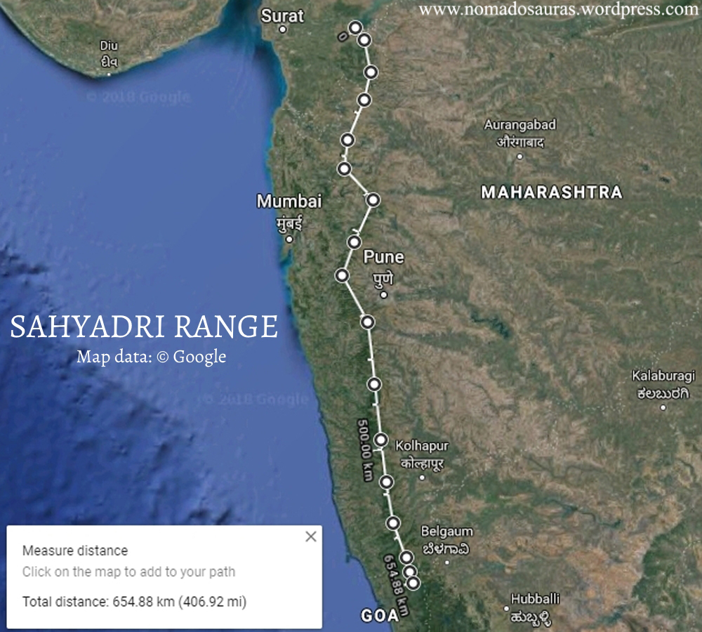
The Western Ghats, a UNESCO world heritage site[1] and one of the eight hottest hotspots of the world[2], run parallel to the Arabian Sea along the western coast of India. Starting from the Tapi River near Surat in Gujarat, they extend approx. 1600 km in the north-south direction, passing through the states of Maharashtra, Goa, Karnataka, Kerala and Tamil Nadu to end near the southernmost tip of India, Kanyakumari.
While I was looking for a map of the Western Ghats to slot in here, I was surprised to find that there isn’t a single high-resolution map available in the public domain! So I went ahead and did the only thing I know to do in such cases- I made one

This is a scaled down version of the map. For the original file measuring 2851 by 5051 pixels, click on the link below.
Google Drive link of High resolution Map. (Opens in a new tab)
Although the term ‘Sahyadri’ is widely used to describe the entire Western Ghats, geographically, it is a segment of the Ghats[3] like the Nilgiri, Anamalai, Cardamom & Ashambu hills[5-10]. Specifically, the northern part of the Western Ghats upto the Terekhol river in Goa, spanning 650 km, is called the Sahyadri Range [4].
TERRAIN FEATURES:
The Sahyadri hills are home to a number of different terrain features and identifying as well as understanding them can be a source of great joy! As you get familiar with a region, you start looking out for the peaks like you would for an old friend. As if that isn’t enough, it can also come in handy during emergencies when one has to relay/pinpoint someone’s location.
Note:
1. The feature’s Marathi names (in the Devanagari as well as Latin
scripts) have been provided to help understand the signs, maps and
markers (usually inscribed in Marathi) found at regular intervals on the
trail.
2. I have refrained from using
topographical jargon but some terms do not have an equivalent in the
layman’s language and therefore, have been used as a last resort.
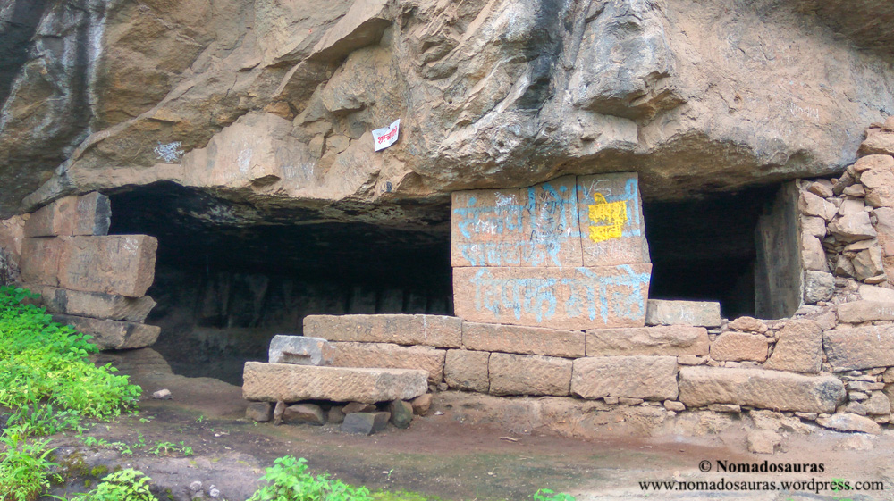
Cave (गुहा/Guha)
The caves found in the Sahyadri range are prominently rock
shelters — a shallow cave-like opening at the base of a cliff/hill
formed out of erosion. Most of the caves sport intricate carvings and in
some cases, scriptures as well.

Buddhist rock-cut caves on the other hand, are elaborate cave complexes with stupas and gigantic statues often carved into the rock walls.
Other well known examples include the Ganpati Gadad caves near Murbad and Kondheshwar caves near near Karjat.
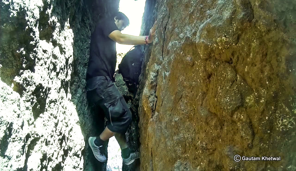
Chimney
Chimneys are a very steep narrow cleft, cracks or fissures in
cliffs, by which a rock face may be climbed. Most of the chimney
sections in the Sahyadri are too dangerous to be attempted by anyone
except professional rock climbers but fret not! People like you and me
can still experience the thrill of pushing up the narrow walls with your
back, courtesy Padargad!
Cliff (कडा/Kada)
A cliff is a vertical, or nearly vertical,
rock face formed by the processes of weathering and erosion. The Konkan
Kada, is the most famous example of a cliff in the Sahyadri.

The 1800 feet high concave cliff has been climbed only twice since the first ascent in 1985. Reason? Look at it yourself!

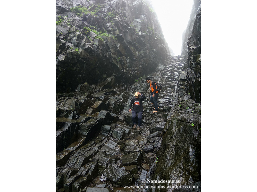
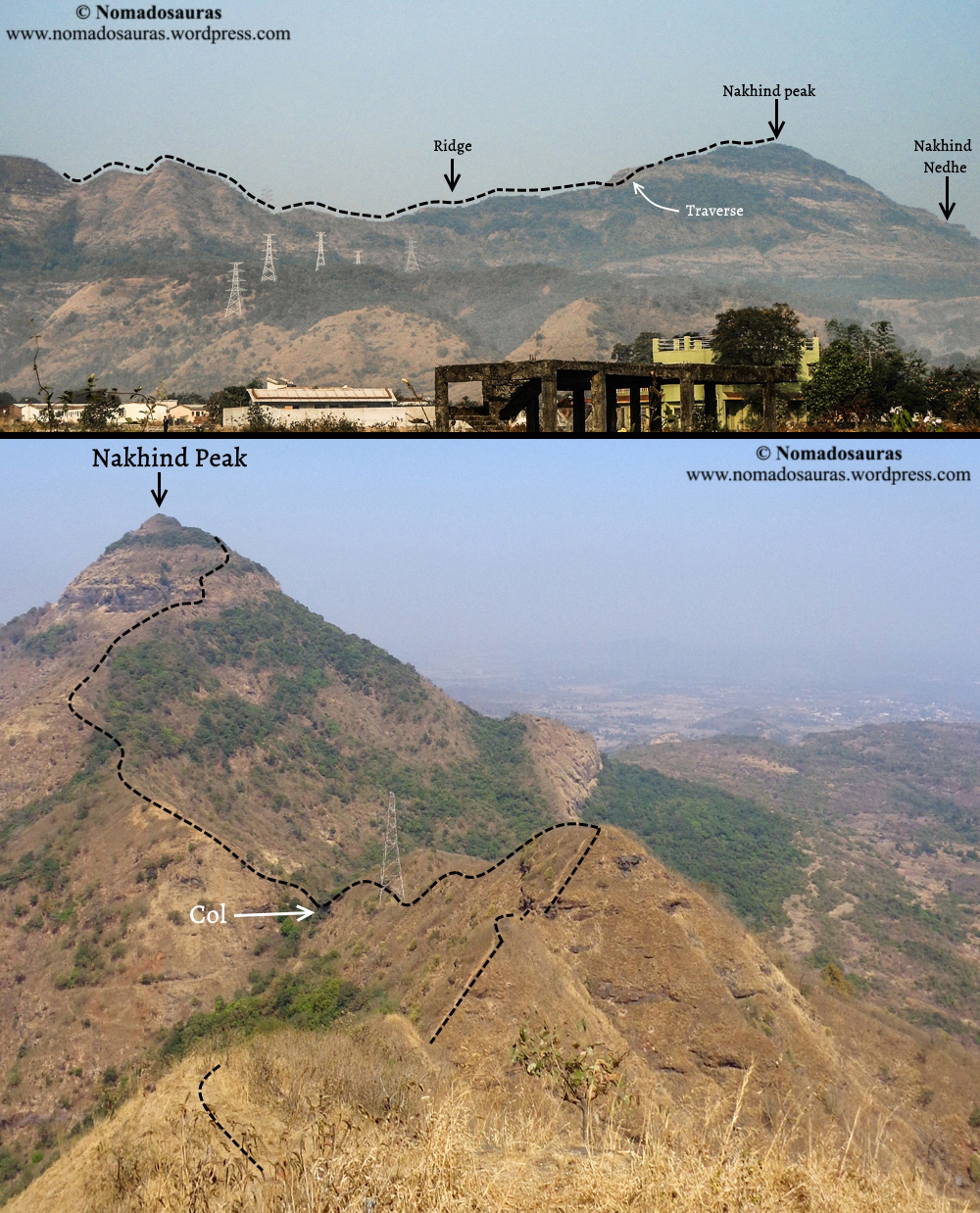
Col
A col is the lowest point on a mountain ridge between two peaks.

You have
already got acquainted with the Nakhind-Vikatgad col at the beginning of
this post. Here’s the col on the other side of Vikatgad- between
Matheran and the southern bastion of Vikatgad.
a.

b.

Draw (नाळ/Naal)
A draw is formed by two parallel spurs with low ground in between them.
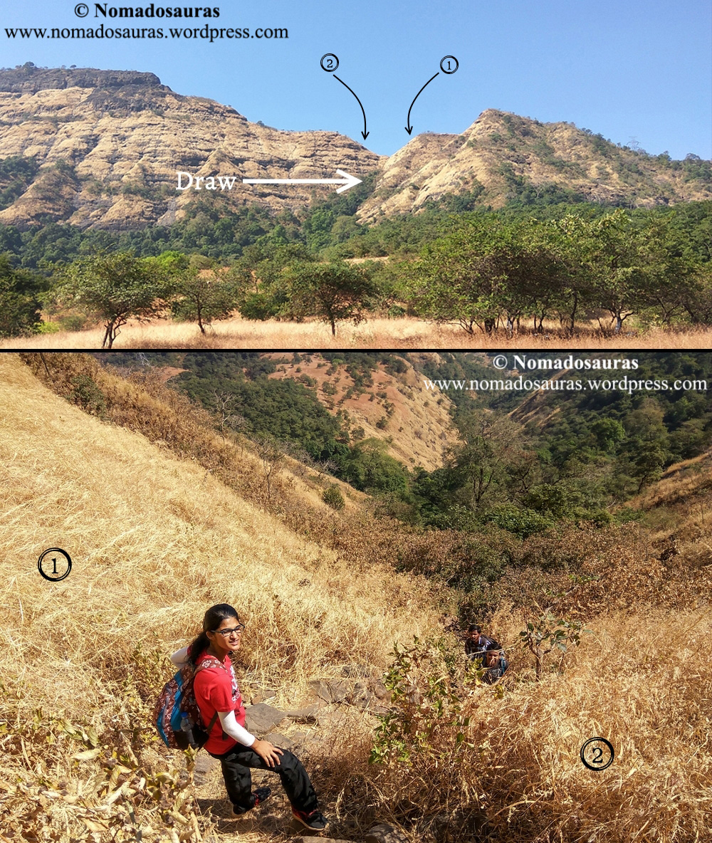
It is usually etched in a hillside by water flow and may contain an ephemeral stream or loose rocks from the eroded rock fall.
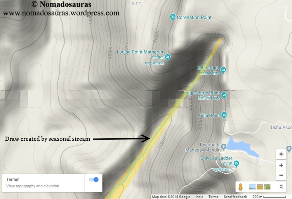
The very first Naal ascent I did was back in July ’15 when 8 of us climbed an 80 m high naal near the Pisarnath Mandir of Matheran during a torrential downpour. Sahyadri trekkers are a creative bunch, as is evident from the unique names they often give to certain routes. So you know a naal isn’t supposed to be taken lightly when they drop the tongue-in-cheek humour and instead name a route so as to clear any doubts you might have about its difficulty. The popular name of the Pisarnath ladder route? Danger trail
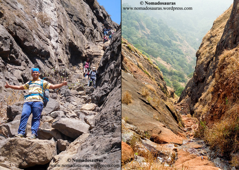
Harishchandragad via Nalichi Vaat, Hadsar via Naal, Dhak Bahiri via the Kalakrai Naal are some other famous naal trails in Sahyadri.
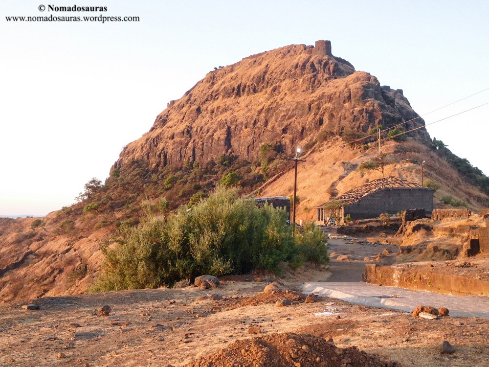
Hill (डोंगर/Dongar)
A hill is a landform that extends above the
surrounding terrain. It often has a distinct summit, although in areas
with scarp/dip topography a hill may refer to a particular section of
flat terrain without a massive summit. Mountains generally are
understood to be larger than hills, but the term has no standardized
geological meaning.
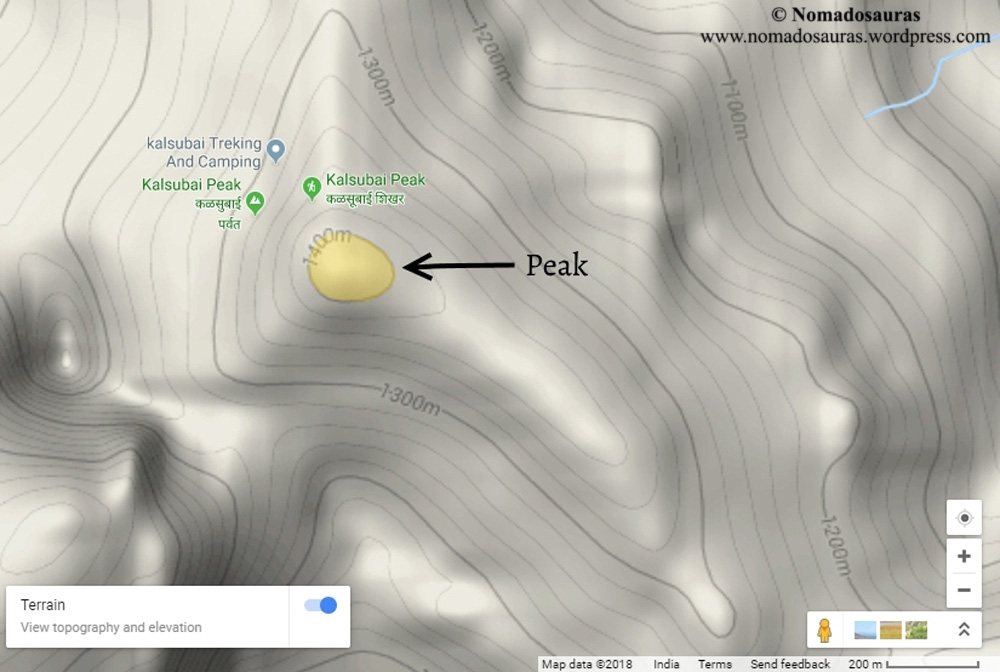
The highest peak of Maharashtra, Kalsubai
is the best known example of a non-fort hill. I‘ll like to take this
opportunity to mention a fun fact- even though Kalsubai is the highest
peak of Maharashtra, it isn’t the highest climb in the Sahyadri. That
honour belongs to Kulang fort.
How? Google ‘Topographic Prominence’
Hillock (टेकडी/Tekdi)
A small hill or mound.

Simply put, Hillock is the Peter Pan of the geological world who (literally!) refused to grow up!
Needle Hole (नेढे/Nedhe)
I got news for you. Nature has it’s own
Except it is a hole formed in a rock face due to weathering/erosion.
Madangad, Irshalgad, Kothaligad, Rajgad,
Nakhind, Ratangad, Harishchandragad are a few forts which can boast of
this relatively rare terrain feature!

Know more? Drop me a mail using the contact form!
Saddle (खोगीर/Khogir)
A Saddle is a dip or low point between two areas of higher
ground, often inline. When a saddle can navigated on foot, it is known
as a pass.
Pass (घाट/ खिंड-Ghat/Khind)
1: A pass is a navigable route through a mountain range or over a ridge.
2: A pass is a gap, or break, in
high, rugged terrain such as a mountain ridge. Passes often provide the
easiest routes for people to travel across steep mountain ranges.

Naneghat is perhaps the most important pass of the Sahyadri (from the point of view of trade).
Legend has it that the huge pot used for collection of toll from the traders using the pass would fill up three times a day! And it still sits pretty besides the pass reminding us of the bygone era.
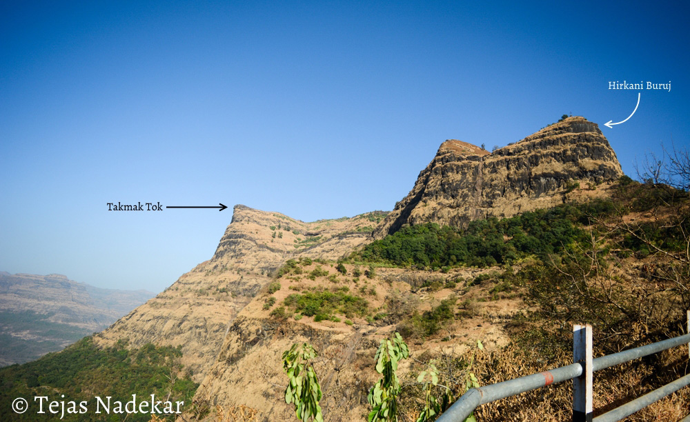
Peak (शिखर / टोक– Shikhar/Tok)
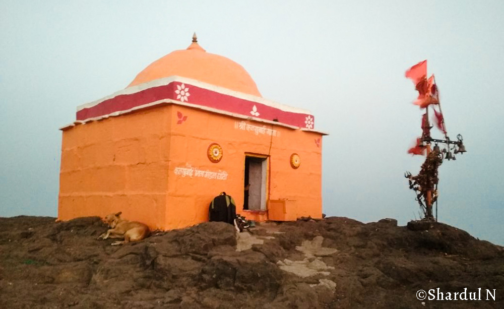
In topography, Shikhar refers to the the pointed top of a mountain or a hill.

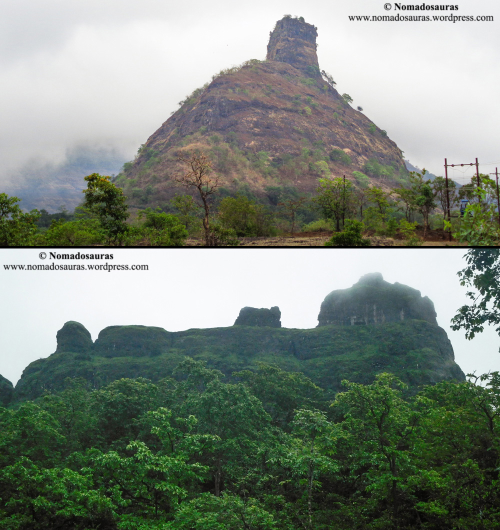
Pinnacle (सुळका/Sulka)

A pinnacle is an individual column of rock, isolated from other rocks or groups of rocks, in the shape of a vertical shaft or spire.

Navrichi Karawli, Hadbichi Shendi, Khada parsi, Vanartok are some of the prominent pinnacles of Sahyadri. Told you, Sahyadri climbers are a creative bunch when it comes to naming!
Plateau (पठार/Pathar)
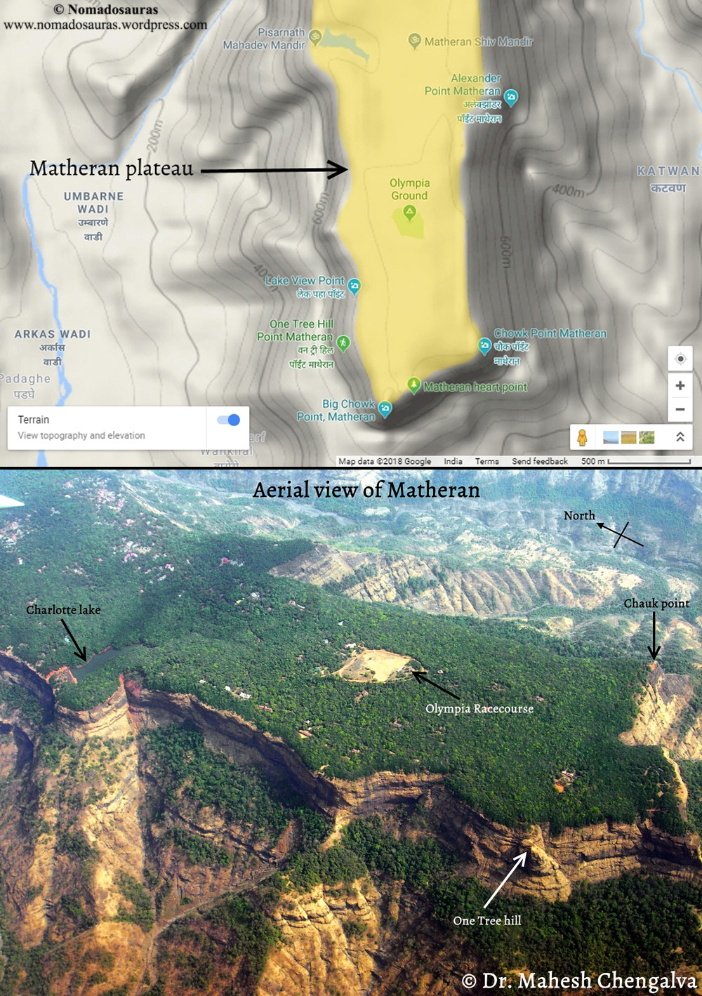
A plateau is a relatively flat, elevated landform that rises sharply above the surrounding area on at least one side and often, more sides with steep slopes.
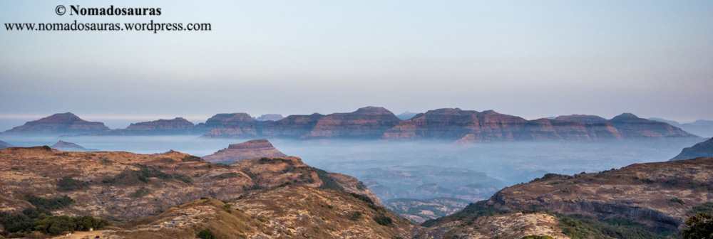
Ridge (धार/Dhaar)

A ridge or mountain ridge is a geological feature consisting of a chain of mountains or hills that form a continuous elevated crest for some distance.
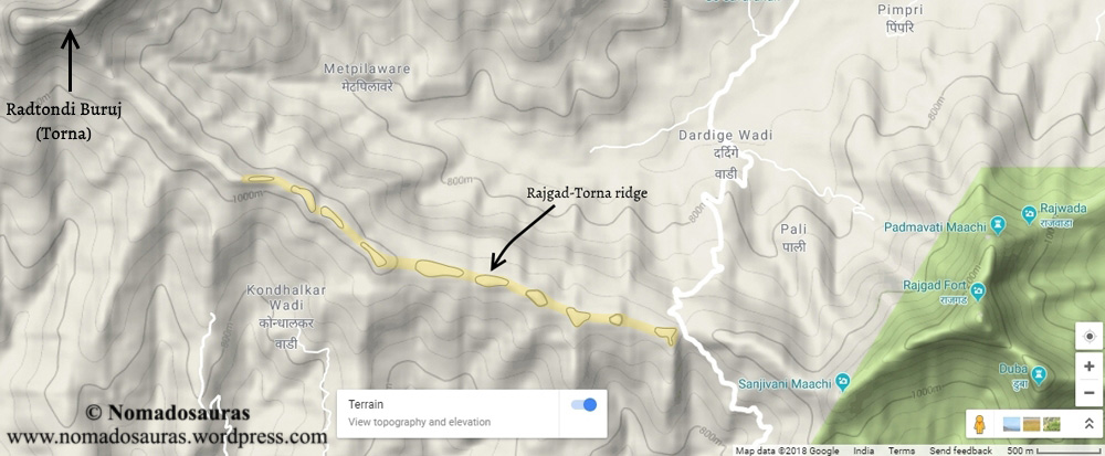
The line along the crest formed by the highest points, with the terrain dropping down on either side, is called the ridgeline.
Rock Patch
A continuous rocky section (often inclined more than 45 degrees) that can be free climbed or may require climbing equipment.
From the easy Vikatgad rock patch to the moderately risky One tree hill or the outright crazy Irshalgad pinnacle, there’s something for every climber, irrespective of your skillset If you dream of sheer rocks walls (And I have no idea why you would do that!), then Sahyadri is the place to be!
Scarp
A scarp is a steep slope or long cliff that forms as an effect
of faulting or erosion and separates two relatively levelled areas
having differing elevations.
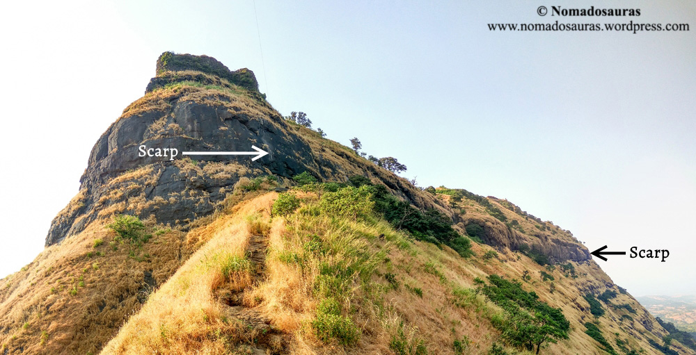
Scarp is a term encompassing a very wide range of terrain features. The Sahyadri is a 650 km long scarp of the Deccan plateau by some accounts!
Shoulder (खांदा/Khaanda)
A point at which a steep slope descends from a plateau or highland area, resembling a shoulder in shape.

Yeeup, you read that right. Mountains have shoulders. And mood swings too. I can vouch for the latter.
Spur (सोंड/Sond)

A spur is a tongue of land descending from a hill, mountain or main crest of a ridge.
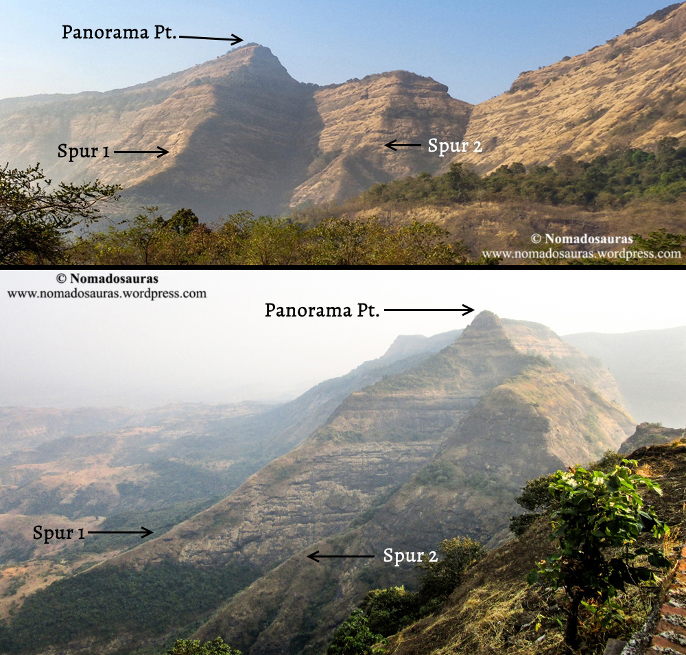
Easy way to identify a spur? Make a fist and point it towards yourself. If the knuckles represent a ridge, the fingers represent the spurs. Nope, don’t do this if you are in a public place. Unless you are Rocky Balboa.
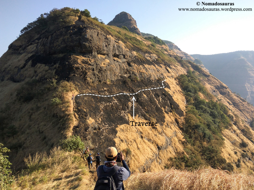
Traverse
A traverse is a lateral move or route, mainly going sideways
rather than up or down. In general mountaineering, a trail usually
traverses the steep gradient of the rock face.
Valley (दरी/Dari)
A valley is a low area most commonly drained by rivers and may
occur in a relatively flat plain or between ranges of hills or
mountains.

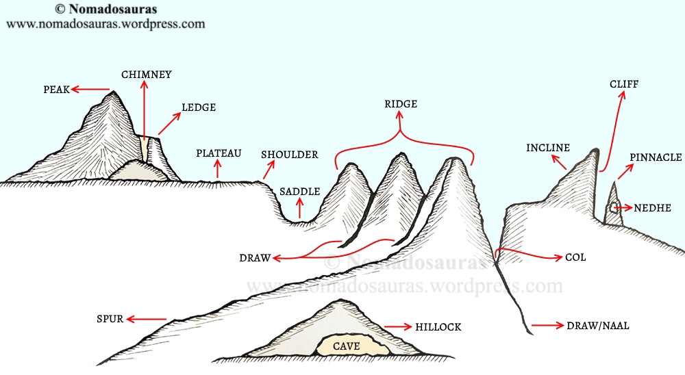
Still confused? Here’s a rough sketch combining the different terrain features! Hope it helps
Picture credits:
Tejas Nadekar’s Flickr account
Dinesh Valke’s Flickr account
Ruturaj Vartak’s Flickr account
Safe Climbing Initiative, Pune
Gautam Khetwal’s Padargad trek video
References:
[1]: https://whc.unesco.org/en/decisions/4781
[2]: https://whc.unesco.org/en/list/1342/
[3]: https://ianlockwood.wordpress.com/2014/06/01/sahyadri-revealed/
[4]: Trek the Sahyadris, 5th Ed- Harish Kapadia
[5]: https://www.britannica.com/place/Nilgiri-Hills
[6]: https://en.wikipedia.org/wiki/Nilgiri_mountains
[7]: https://www.britannica.com/place/Anaimalai-Hills
[8]: https://en.wikipedia.org/wiki/Anaimalai_Hills
[9]: https://www.britannica.com/place/Palni-Hills
[10]: https://en.wikipedia.org/wiki/Palani_Hills
General references:
संगाती सह्याद्रीचा (1995) – Young Zingaroo Trekkers group
Matheran – A Mountaineering Manual- Dr. Mehta, Mrs. Mehta, Ms. Mahajan.
Trekshitiz website
End of Part I- Landforms.
To read Part II- Forts, click here (opens in a new tab)
All rights reserved © 2016 – present Nomadosauras.
Content (including images) not for reproduction in any form, partial or otherwise.
Read complete disclaimer- Terms Of Use.
Cheers!
Keep Trekking
Landforms & Forts- II
This is the second part of the Landforms & Forts series. To read Part I- Landforms, click here. (Opens in a new tab)
Part II: FORTS
Hill fort, Sea fort, Forest fort, Land fort, Watchtower or Military Base. Name it and you’ll find it in the Sahyadri!
Maharashtra is also known as the land of forts and with good reason! The vantage points provided by forts (especially Hill forts) made it easy to spot the enemy forces’ movements from afar and pre-empt any attack. But their strength was also their downfall- coveted by invading forces, they have been witnesses to the bloodiest chapters in the history of the western peninsula of India.
A conservative estimate puts the number of Sahyadri forts at greater than 350, out of which 300 have been documented in the excellent Trekshitiz website[1]. But do not let that number deceive you into thinking they were easy to build. Quite the opposite, in fact!
The fort’s architecture took into account the topography of the hills- identifying plateaus suitable for settlements, carving water cisterns at strategic places to ensure round-the-year water supply, developing possible approaches via the spurs as well as concealing escape routes in the fort walls to flee when needed. Consequently, no two forts were built alike and each one of them is a surviving blueprint of the warfare techniques prevalent then!
Building the colossal forts often required vast capital and manpower but once completed, they became the pillars on which the empire flourished.
Without further ado, let’s look at the major parts of a typical Sahyadri fort:
Shastragare/Darukothar (शाश्त्रागारे/ दारुकोठार)
Shastragare were depots used to store arms and gun powder on the fort.
The clever Army commanders kept their gun powder dry and the weapons spic and span in the near-water tight arms depot.
After all, it spared them the Paresh Rawal’s Tejas-esque blushes in the heat of a battle
Citadel (बालेकिल्ला/Balekilla)
The last line of defence in a fort, Balekillas were often built
on the highest plane of the fort- complete with a granary, an
administrative office and armoury of their own. No wonder they are often
referred to as the fort within a fort!
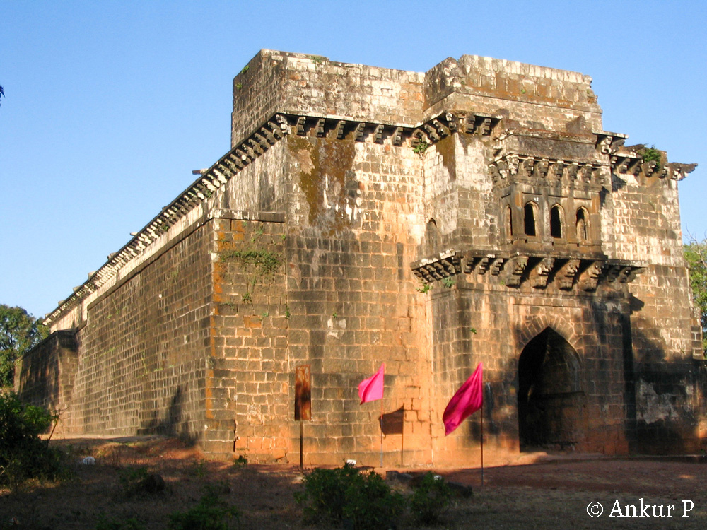
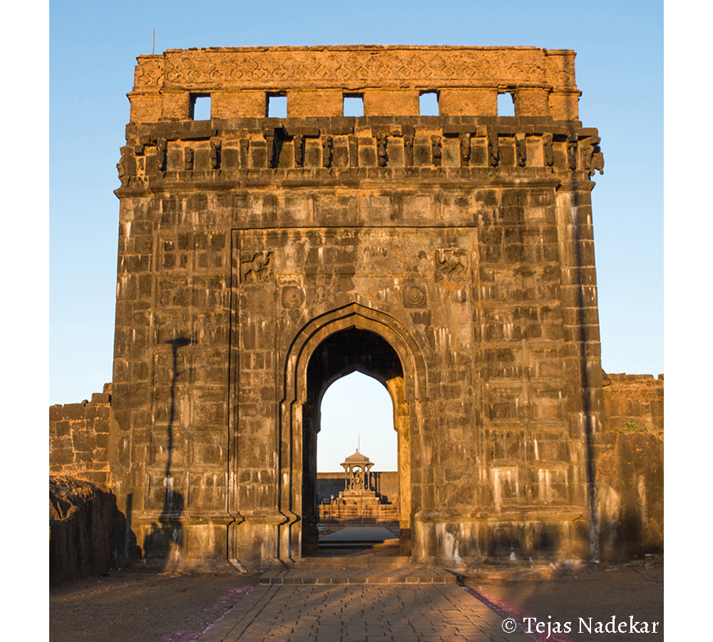
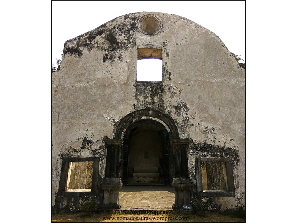
Darwaza (दरवाजा)
The only way
to enter the forts. Except for Tanaji Malusare! He, along with 300
other soldiers climbed a cliff in the dead of the night to enter &
subsequently win the Sinhgad fort (then known as the Kondana fort).
From the Mahadarwaza tall enough to let in
Grawp, the half giant from Harry Potter to the Chor darwaza, barely high
enough to let the House Elf- Dobby pass through, you’ll find the
Darwaza in all shapes and sizes.

The main entrances were the second line of defence after the bastions and often adorned with spikes (to prevent the enemy forces from using Elephants to ram open the door. Or maybe to scare the hell out of enemy soldiers. Either way, they did a fine job of it!).

Even the door’s names tell a story- from the unique names derived from elements of the fort (Palkhi Darwaza, Kothi Darwaza) to the ones symbolically named after important cities/regions of that time (Dilli Darwaza, Kalyan Darwaza, Junnar Darwaza, Pune Darwaza), one doesn’t need to look any further to unearth interesting tales!

Wicket Gate (दिंडी दरवाजा/Dindi Darwaza)
A pedestrian door or gate, particularly one built into a larger door.
Flagpost (ध्वजस्तंभ/Dhvajstambh)
A flagpole was traditionally used to raise
the flag of the reigning rulers of a territory. Presently most of the
forts in the Sahyadri sport the ceremonial Maratha flag as a tribute to
the Maratha warrior king, Shivaji Maharaj (1630-80).

Granary (अंबारखाना/Ambaarkhana)
Granaries were storehouses used for storing grains and other
consumables. They were essential to surviving a prolonged siege attempt
on the fort and hence the armies built massive granaries to provide for
the mini-city that were the forts.
Bastion (बुरूज/Buruj)
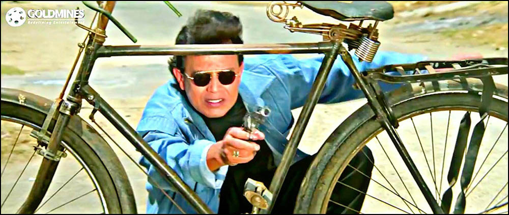
Unless you are Mithun Chakraborthy, you
would want more than a cycle for cover when the enemies are raining you
with arrows and spears.
This is where a Bastion comes in!
Bastions are the projecting part (usually semi-circular) of a fort built at an angle to the line of a wall, so as to allow defensive fire in several directions.

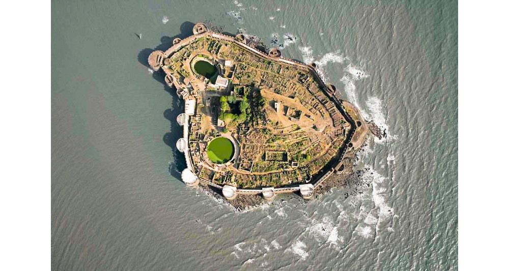
An aerial look at the undefeated Janjira fort, which had 26 (twenty-six!) bastions will tell you that ‘more the merrier’ seems to have been the mantra back in the days!
Machi (माची)
Machi were fortified plateaus or spurs used for settlement or patrolling, respectively.
Moats/Ditches (खंडक/Khandak)
Moats were deep trenches dug around the periphery of a fort & filled with water that acted as an additional line of defence.
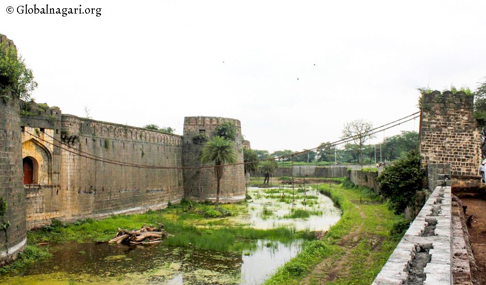
By some accounts, the moats would often be infested by poisonous snakes and crocodiles to prevent enemies from swimming over to the fort walls when the bridges had been withdrawn. I haven’t been able to verify this, though. So take it with a pinch of salt.
Naagarkhana (नागरखाना)
Naagarkhana or Drum houses were essentially watch-posts built inside the fort. They were also used to draw the attention of the people inside/around the fort using drums, whenever needed.
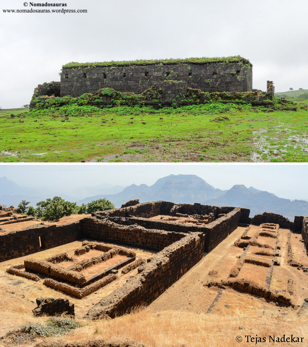
Palace (राजवाडा/Rajwada)
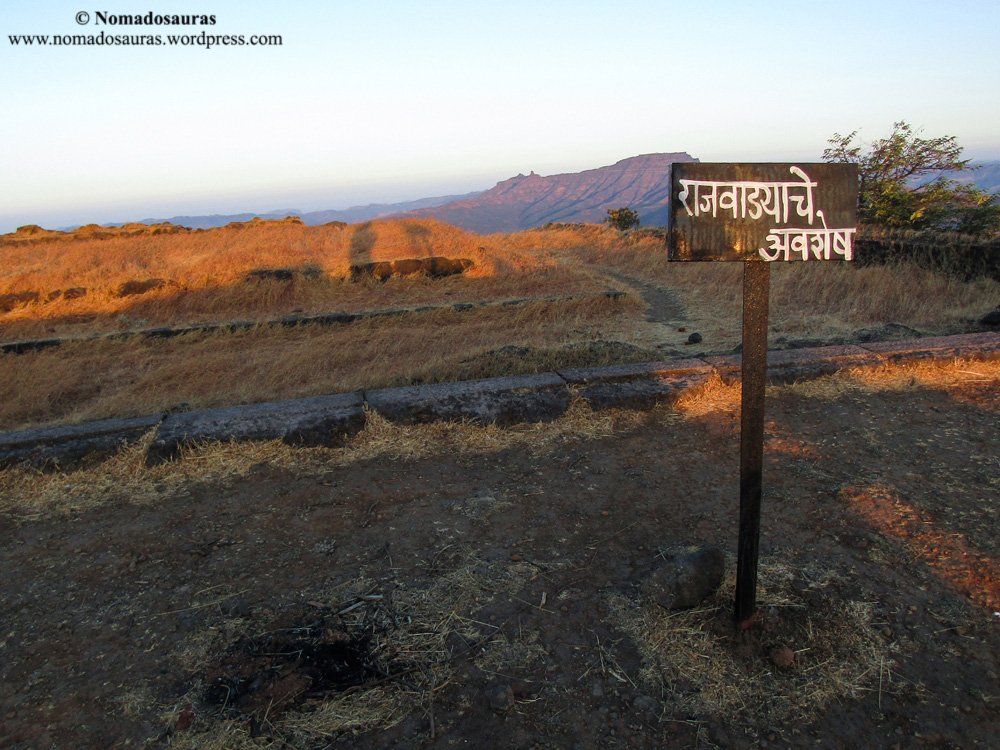
Probably the
most spacious structure on the fort in its heydays, Rajwada was the
place of residence for the members of the Royal family.
The biggest Rajwades have crumbled under
the nature’s fury and all that remains is their foundation or the base
layer of the walls but a few smaller ones remain intact.
Places of Worship

The armies had soldiers and generals from every faith and religion and hence, almost every fort in the Sahyadri shows signs of multiple places of worship including Temple, Mosques and in the case of Portuguese forts, churches as well!
Pond (तळ)
A pond is a body of standing water on the fort, either natural or artificial, that is usually smaller than a lake.
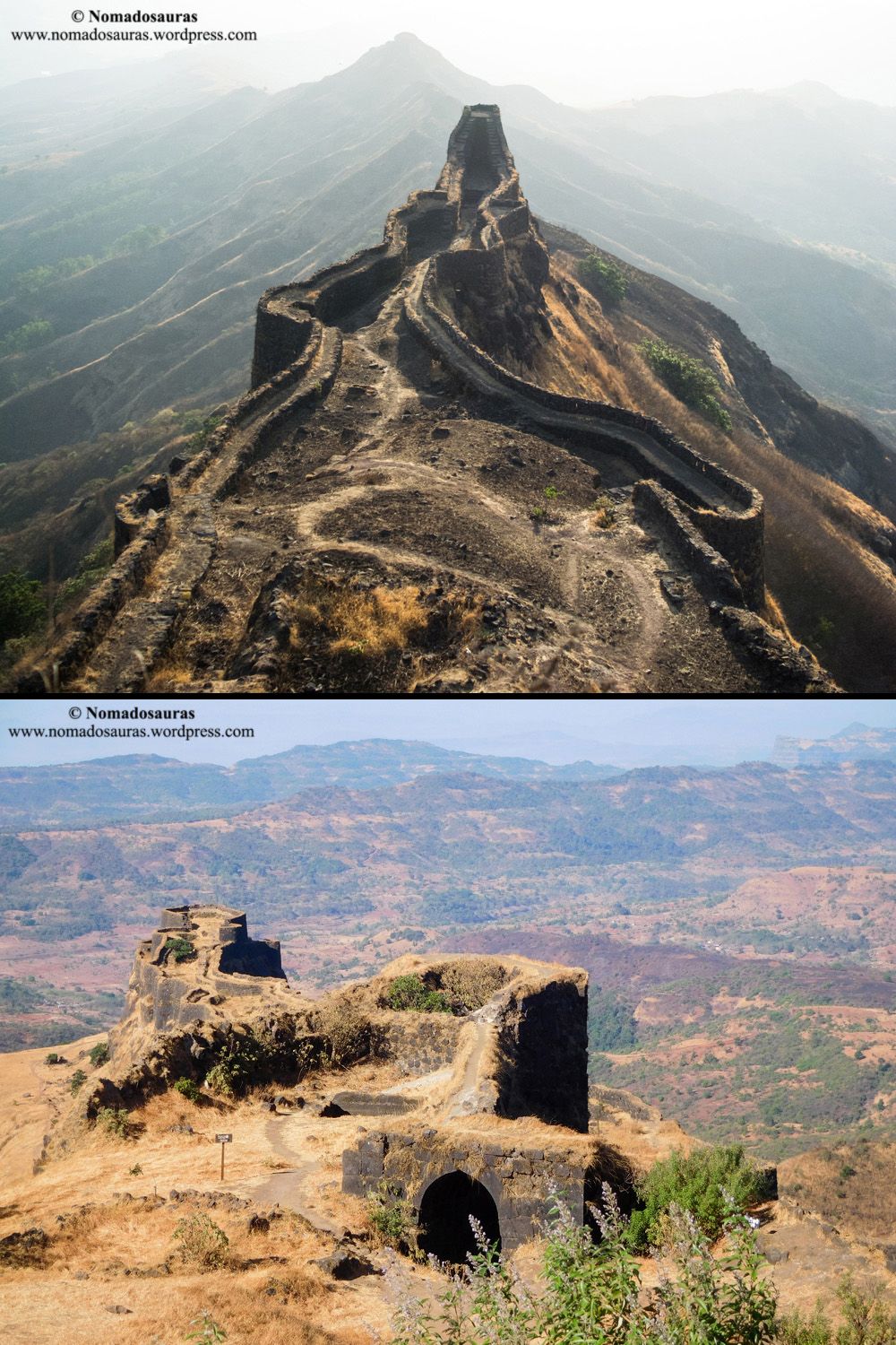
Rampart (तटबंदी/Tatbandi)
Ramparts are the defensive wall of the
forts with a stone parapet on top. Most of Sahyadri fort’s ramparts
sport a walkway broad enough to let 1 or 2 people pass each other
without resorting to acrobatic poses.
One also comes across a few instances where
ramparts were built as a double wall to incorporate secret passageways
and dead ends so as to trap enemy soldiers unfamiliar with the fort.

Rock Cut Step
A lot of forts were built atop treacherous cliffs and the only way to reach them was by a single path carved into the cliff. Steps were hewn out of sheer rock to help negotiate the more dangerous sections but they were purposely carved in a steep, uneven manner to prevent attacking soldiers from building any rhythm over the steps. This enabled even small holding forces to withstand attacks until reinforcements arrived.
Unfortunately, most of the forts in the Sahyadri had their approach steps partially/completely demolished by the East India Company in the early 19th century to prevent rebels from using them as a base in their war against the British Empire. This has led to a few forts being rendered inaccessible and others, restricted to people with rock climbing equipment.
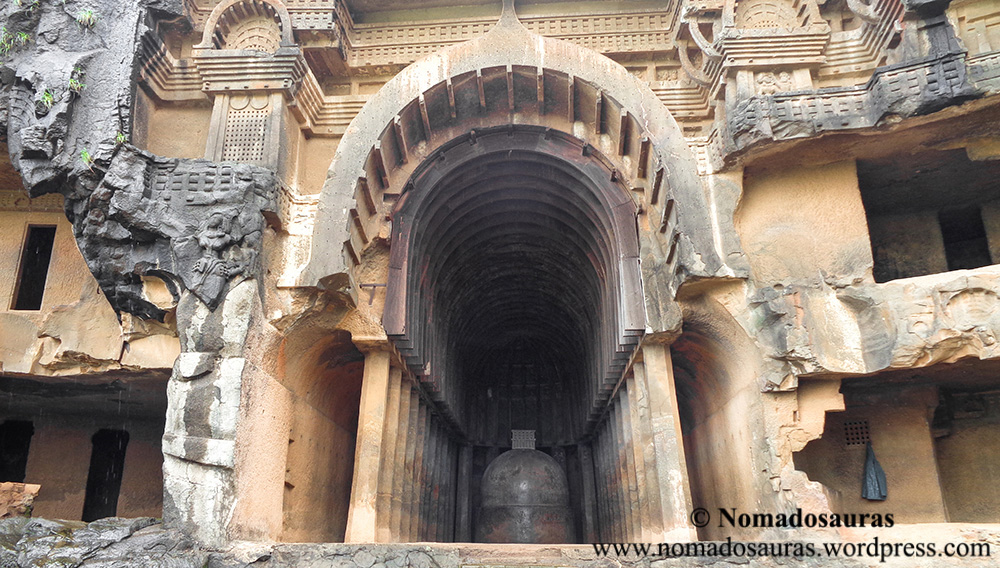
Tunnel (भुयार/Bhuyar)
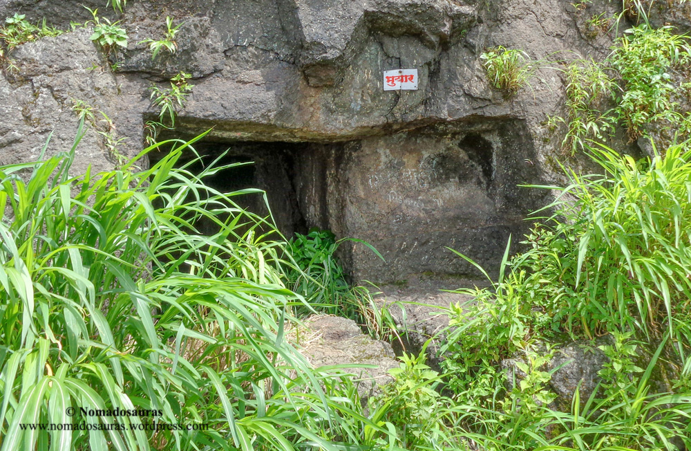
The typical Sahyadri tunnel was a tiny passageway carved in a rocky structure. The motives were varied though- providing an escape route from the fort to the surrounding region (Fort George, Mumbai) or connecting a fort and its watchtower (Prabalgad-Kalavantin) and to provide access to an underground storage facility (Vikatgad). Unfortunately, neglect has led to most of the tunnels being permanently blocked at one or both the ends.
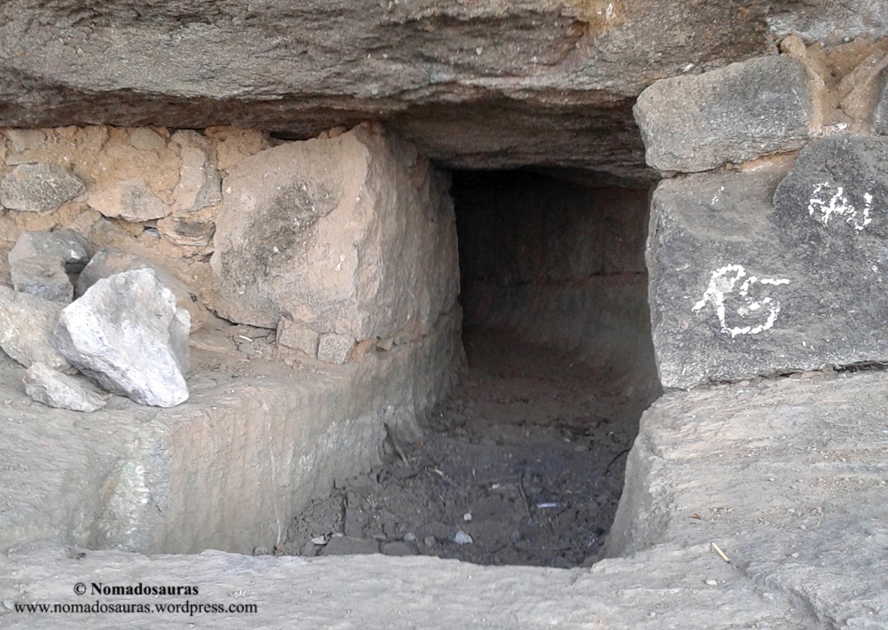
Note: Trekkers are cautioned against exploring undocumented tunnels in the vicinity of a fort as they may be susceptible to collapsing.
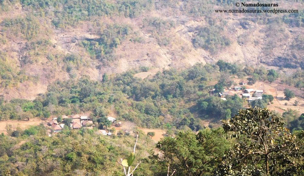
Village/Hamlet (गाव / वाडी)
Small cluster of homes (wadi) often cropped up near the forts
in the fertile valleys and foothills of the Sahyadri range and also
doubled up as watch posts. Their job was to warn the fort’s guards and
prevent them being blindsided by invading forces.
Watchtower
A watchtower is a type of fortification
built primarily for military purposes and to provide a high, safe place
from which a sentinel or guard may observe the surrounding area.
eg: Irshalgad/Kothaligad/Kalavantin
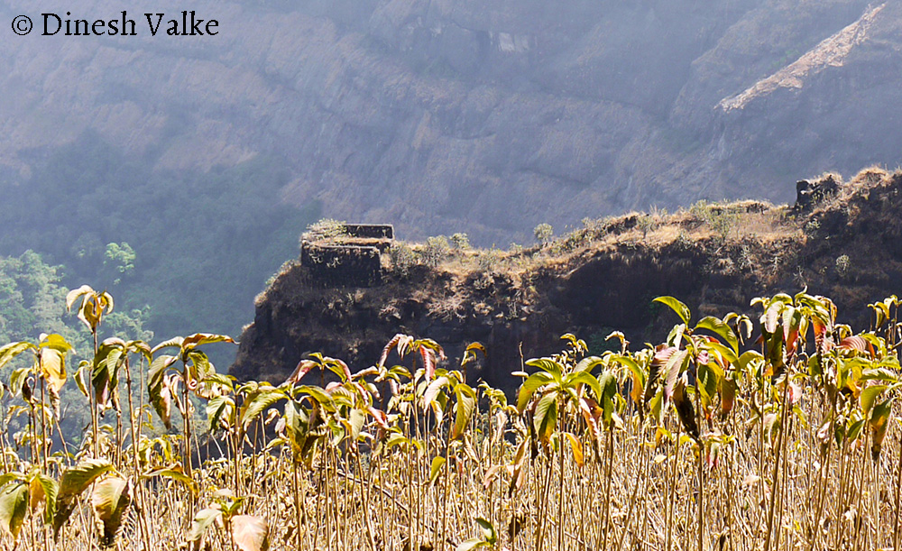
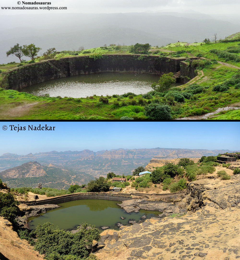
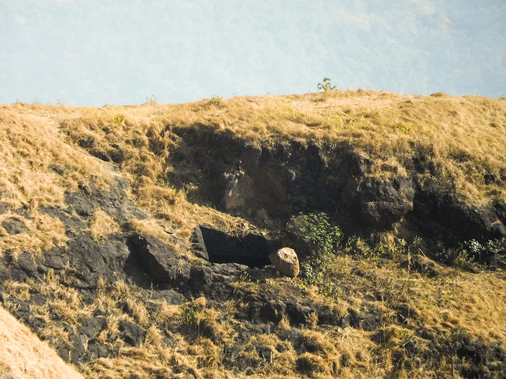
Water Cistern (पाण्याची टाकी/ Panyachi Taaki)
Water cisterns in the Sahyadri were carved in sheer rock to
catch and store rainwater for the purpose of drinking and other uses all
year round.

A careful look at the way forts were constructed will put today’s civil planners to shame. The rainwater management was eons ahead of its time. Networks of cascading water tanks carved in an incline to make sure the excess runoff from the highest cisterns filled up the lower ones!

Ranging from the gigantic water tanks at Visapur to the miniscule cisterns near the Chanderi fort, you ‘ll find one in almost every fort.
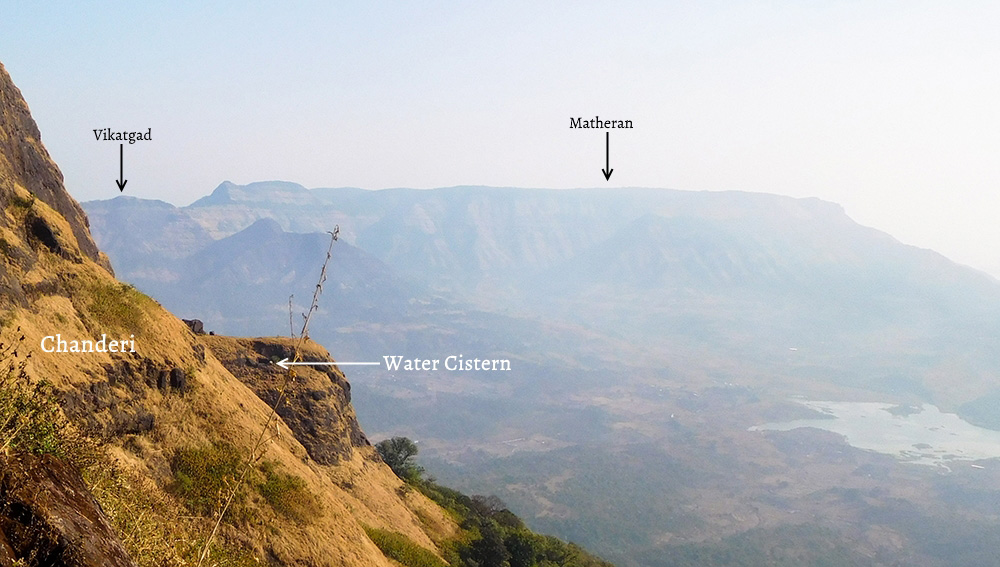
Can’t see the Water cistern? Let’s zoom in!
Infact the existence of a water tank is a very reliable differentiator (in case of no surviving fortification) between a fort and a normal hill.
Note:
Most of the water tanks on forts have been rendered useless by natural
siltation and irresponsible littering by people visiting the forts. Not
only is this unfortunate but it is also contributing to the slow death
of self-sufficient trekking in the Sahyadris with people undertaking
range treks forced to rely on vendors near the forts for drinking water.
Do the environment and your future generations a favour- Do not litter.
I hope the next time you plan a visit to any one of these forts, you’d be tempted to check its layout and a bit of its (hopefully storied) history as well. Not only does it add another dimension to the treks, but it also leaves one awestruck at the sheer expertise & effort that helped transform these mere hills into impregnable strongholds!
Cheers & Happy Trekking!
Picture credits:
Tejas Nadek’s Flickr Album
Dinesh Valke’s Flickr Album
Ankur P’s Flickr Album
Ahmednagar Tourism
References:
[1]: Trekshitiz Website
General references:
संगाती सह्याद्रीचा (1995) – Young Zingaroo Trekkers group
Matheran – A Mountaineering Manual- Dr. Mehta, Mrs. Mehta, Ms. Mahajan.
http://marathachronicles.blogspot.in
All rights reserved © 2016 – present Nomadosauras.
Content (including images) not for reproduction in any form, partial or otherwise.
Read complete disclaimer- Terms Of Use.
Cheers!
Keep Trekking


No comments:
Post a Comment